Journal of Remote Sensing & GIS
Editorial Board
Biography
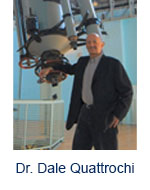 |
Dr. Dale Quattrochi is a Senior Research Scientist in the Earth Science Office at the NASA Marshall Space Flight Center located in Huntsville, Alabama. He received his Ph.D. Degree in Geography from the University of Utah in 1990. He has been a research scientist with NASA since 1980 and has over 35 Years of Experience in the field of land surface remote sensing. His Areas of Expertise include: Urban remote sensing using thermal infrared data, Applications of remote sensing data to human health, and Integration of remote sensing data with GIS. He is the author of three books on remote sensing. He is the recipient of the NASA Medal for Exceptional Scientific Achievement, NASA’s highest science award, and the Association of American Geographers Remote Sensing Specialty Group, Outstanding Contributions Award. |
|---|
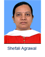 |
Shefali Agrawal Head, Phogrammetry & Remote Sensing, Indian Institute of Remote Sensing, India. Scientist at IIRS (1993 onwards), Project Scientist at IIRS ( 1992-1993), M.Sc Gold Medalist, Astronomical Society of India and ISRO award for best Women Scientist.Currently also Course Director, M.Tech RS & GIS responsible designing of new course curricula encompassing frontier research, new course and future planning. M. Sc/PG Diploma/Mtech/ B. tech project supervision. Indian Society of Remote Sensing, ITC alumni association, Indian National Cartographic Association. |
|---|
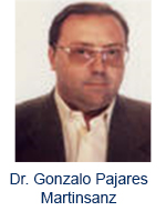 |
Dr. Gonzalo Pajares Martinsanz Office 341 Facultad de Informática He did his Ph. D. in Physics in 1995, at the UNED. My Doctoral dissertation was on "Stereovision Matching" applied to robotics. From 1990 to 2000 I was working in embedded Software for Real Time Applications. From 2000 to 2003, he was working in Remote Sensing applications for image processing at Indra Space, S.A.. Since 1995 to 2004 I have been with the Department of Computer Architecture and Systems Engineering at the Complutense University, where hewas a Professor.Since 2005 to 2007 I have been with the Department of Informatics Systems and Programming at the Complutense University, where he was a Professor.Since 2007 I have been with the Department of Software Engineering and Artificial Intelligence, where he is currently a Professor. |
|---|
 |
Nicola Masini AD(CNR-IBAM (Istituto per i Beni Archeologici e Monumentali), Lecce, Italy Senior Researcher of CNR-IBAM • Responsible of CNR-IBAM (Istituto per I Beni Archeologici e Monumentali) - seat of Tito Scalo (Potenza). • Director of CNR International Mission for Archaeogeophysics and Heritage Conservation in Peru and Bolivia (ITACA) • Manager of a CNR Research Commitment “Integrated diagnostic Methodologies for preservation of the architectural and archaeological heritage in the Mediterranean basin” (IBAM, seats in Lecce and Potenza • Adjunct Professor of Architectural Restoration in the Faculty of Architecture of University of Basilicata – Seat of Matera • Adjunct Professor of Science of Conservation of Architectural Heritage of University of Basilicata – Seat of Potenza • Visiting Professor at the Universita Politecnica of Valencia (ETSIE). • Scientific responsible of Great Relevance Project Italy-China “Smart management of cultural heritage sites in Italy and China: Earth Observation and pilot projects”. |
|---|
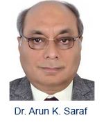 |
Dr. Arun K. Saraf Head Of Department, Indian Institute of Technology , Rorkee, India. INSA – Royal Society, U.K. Fellowship - 2002 b. National Remote Sensing Award-2001 c. GIS Professional of the Year-2001 d. National Scholarship for Study Abroad 1986, Govt. of India e. Indo-US S&T Fellowship, 1994-95 f. Khosla Research Award '96 g. Khosla Research Prize'96 h. Khosla Research Prize'97. Membership in scientific and professional societies: (a) Indian Society of Remote Sensing (ISRS) (b) Indian Society of Geomatics (ISG) (c) International Association of Hydrological Sciences (IAHS) (d) Indian Society of Earthquake Engineering (ISET) (e) Indian Association of Soil and Water Conservationists (IASWC). |
|---|
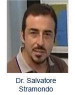 |
Dr. Salvatore Stramondo Faculty Member, National Earthquake Center, Istituto Nazionale di Geofisica e Vulcanologia. Artificial Neural Network, Data Mining, Computing in Mathematics, Natural Science, Engineering and Medic |
|---|
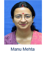 |
Manu Mehta Scientist SD, Indian Institute of Remote Sensing, Indian Space Research Organization (ISRO), India.. Atmospheric parameter retrieval, Time series analysis. Research ExpertiseRemote sensing Physics, Atmospheric correction for satellite data, Aerosol optical depth retrieval from satellite data, Time series analysis of atmospheric and land surface parameters. Scientist/ Engineer SD, IIRS, 2012 – Till date. Scientist/Engineer SC, IIRS, 2010-2011. Engineer (Product Verification), Tejas networks, Banglore 2009. |
|---|
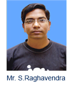 |
Mr. S.Raghavendra Scientist SD, Indian Institute of Remote Sensing, Indian Space Research Organization (ISRO), India.LiDAR, GPS , and Remote Sensing. Presently involved in EOAM (Earth observation and application mission) spaceborne (ICESat) LiDAR project. Member of ISRS |
|---|

